 Arriving
at "John O' Groats" on the far northern corner of the Scottish mainland
with the small passenger ferry (bicycles can be taken aboard) from Burwick
on the southern tip of South Ronaldsay, Orkney Islands, we're pleased to get
our feet back onto solid ground. This little gap between the Isles and the
mainland, known as the Pentland Firth, can be quite often pretty rough, even
in good weather. Ever wondered how it may feel crossing the Atlantic in a
rowing boat? Well, believe me, you're sure to become an insight when crossing
here on this small ferry! Our first overnight stop will be at the local campground
in Thurso. The place is bustling here with tourists and even a few cyclists
are already camped up, so it might turn out to be a pleasant evening. As the
sun slowly sinks beyond the horizon many people gather at the perimeter fence
looking over the sea towards the Orkney Islands to await the glowing of the
"old man of Hoy" (the western cliffs of the Isle of Hoy, that light
up deep orange and red on a clear summers evening just before sunset). As
the last few seconds of sunlight slowly fade to an end, the clicking of cameras
is not to be overheard. Later, we enjoy an evening of cycling discussions
with Bill and Sandra, a couple from Leeds touring around northern Scotland
on their first bicycle tour. Joss and Helga from Denmark also underway from
Aberdeen to the Shetland Islands are having great fun even if "as Joss
puts it, his backside is causing him quite a bit of discomfort". As night
starts to creep in, we're joined by yet another cycle-tourer, Marco from Augsburg
in southern Germany. He misses his family and the lacking of bike-paths or
sufficient shoulders on the roads, which unfortunately Scotland does not have
a great deal to offer. Nevertheless, cycling through the Highlands is indeed
quite spectacular. As we reach Bettyhill, halfway along the northern coastline,
it's now time to head inland and unfortunately leave the rugged coast behind
us for a while (that's one good advantage of cycling around Scotland, you're
never too far away from the next coastline). Following "single-track"
roads now, our chosen route slenders due south along traffic sparse hilly
and bumpy roads passing "Loch Naver" on the way. These damned midges
(small, bloodthirsty biting insects) seem to just hang around here in great
swarms awaiting the poor, fatigued cyclist to past, in order to start their
attack. For fear of choking on mouthfuls of these beasts while passing through
the swarms, it's better to keep the head down, mouth closed and let the thigh
muscles take over in hope of evading them quick enough. Especially around
the eyes and ears, we find little itching, red and swollen lumps starting
to appear. At least, these beasts vanish for the night as soon as the sun
sets in the evening, this giving us the freedom of sitting outside our tent
and enjoying our evening meal in peace. Soon, we head into the busy town of
Inverness.
Arriving
at "John O' Groats" on the far northern corner of the Scottish mainland
with the small passenger ferry (bicycles can be taken aboard) from Burwick
on the southern tip of South Ronaldsay, Orkney Islands, we're pleased to get
our feet back onto solid ground. This little gap between the Isles and the
mainland, known as the Pentland Firth, can be quite often pretty rough, even
in good weather. Ever wondered how it may feel crossing the Atlantic in a
rowing boat? Well, believe me, you're sure to become an insight when crossing
here on this small ferry! Our first overnight stop will be at the local campground
in Thurso. The place is bustling here with tourists and even a few cyclists
are already camped up, so it might turn out to be a pleasant evening. As the
sun slowly sinks beyond the horizon many people gather at the perimeter fence
looking over the sea towards the Orkney Islands to await the glowing of the
"old man of Hoy" (the western cliffs of the Isle of Hoy, that light
up deep orange and red on a clear summers evening just before sunset). As
the last few seconds of sunlight slowly fade to an end, the clicking of cameras
is not to be overheard. Later, we enjoy an evening of cycling discussions
with Bill and Sandra, a couple from Leeds touring around northern Scotland
on their first bicycle tour. Joss and Helga from Denmark also underway from
Aberdeen to the Shetland Islands are having great fun even if "as Joss
puts it, his backside is causing him quite a bit of discomfort". As night
starts to creep in, we're joined by yet another cycle-tourer, Marco from Augsburg
in southern Germany. He misses his family and the lacking of bike-paths or
sufficient shoulders on the roads, which unfortunately Scotland does not have
a great deal to offer. Nevertheless, cycling through the Highlands is indeed
quite spectacular. As we reach Bettyhill, halfway along the northern coastline,
it's now time to head inland and unfortunately leave the rugged coast behind
us for a while (that's one good advantage of cycling around Scotland, you're
never too far away from the next coastline). Following "single-track"
roads now, our chosen route slenders due south along traffic sparse hilly
and bumpy roads passing "Loch Naver" on the way. These damned midges
(small, bloodthirsty biting insects) seem to just hang around here in great
swarms awaiting the poor, fatigued cyclist to past, in order to start their
attack. For fear of choking on mouthfuls of these beasts while passing through
the swarms, it's better to keep the head down, mouth closed and let the thigh
muscles take over in hope of evading them quick enough. Especially around
the eyes and ears, we find little itching, red and swollen lumps starting
to appear. At least, these beasts vanish for the night as soon as the sun
sets in the evening, this giving us the freedom of sitting outside our tent
and enjoying our evening meal in peace. Soon, we head into the busy town of
Inverness.
Now, our route slenders along the eastern side of the world famous "Loch
Ness". The Loch itself is quite narrow yet rather long, about 25 miles
to be precise and is surrounded by rounded high hills. Just before Foyers,
a small village hosting a wonderful waterfall and a small shop, we tackle
probably the most steepest of nasty little hills on all of our journey so
far. As of yet, "Nessie" hasn't shown up, so we'll have to wait
until sometime in the future to maybe catch an eerie glimpse! Fort Augustus
awaits us with an impressive series of Locks, their gates and sluices allowing
boats to transfer from the higher water levels of Loch Lochy (well actually
the Caledonian Canal and the small Loch Oich) to the lower levels of Loch
Ness, thus connecting the east and west coast. Again, we find a nice and friendly
campsite at the end of town and some lovely Scottish pubs in town as evening
breaks in. The highest mountain in the United Kingdom, "Ben Nevis 4406
ft/ 1364 m" pears through the morning clouds as we make our way southwest
towards Fort William.
We decide to stay a few days in the campground at "Glen Coe"(this
valley is full of mystical legends and tragical occurrences like; the believed
witch "Bean Nighe" who washes her clothes in the Coe stream and
if sighted guarantees the sure death of the viewer in the very near future.
No wonder, she was believed sighted on the evening of the 12th of February
1692 as in the early hours of the next morning the massacre of Glen Coe took
place. 38 soles lost their lives on this cold, wintery morning and those few
hundred that evaded sure death, were only to perish during the rest of the
long, cold winter in the surrounding terrain).
This is indeed a place, well worth at least
a few days exploring. 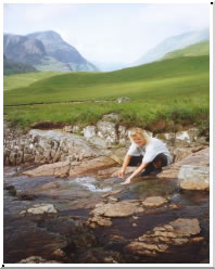 Pushing
on, it's time for us to head now, in the main direction of Glasgow, but we'll
be heading off southwest just before reaching Scotland's largest city and
crossing over the mighty Erskin bridge. The main road (A82) is however, rather
choked with traffic and unfortunately offers no side shoulder to speak of.
It's mostly downhill along the greater part of the way and the surrounding
scenery is to say the least, very spectacular. Care must however, be taken
when cycling along this busy road next to the very beautiful Loch Lomond as
it turns and twists its way along the narrow, and tree shady western bank
of this loch. Reaching the southern end, the road then widens out. Cycling
over the Erskin bridge is easy, thanks to a wide pedestrian path. Our tour
is almost now, at an end. Our destination of Ayr on the southwest coast lies
only a good day ahead at the most. The cycling is easy as we divert onto small,
traffic sparse side-roads. It has indeed been quite an adventure after-all.
Resting up in Ayr for a few days before returning home gives us the chance
to look back over our route along the map. Almost 3000km and 7 weeks underway
from our starting point on the German/Danish border is quite a memorable accomplishment.
Pushing
on, it's time for us to head now, in the main direction of Glasgow, but we'll
be heading off southwest just before reaching Scotland's largest city and
crossing over the mighty Erskin bridge. The main road (A82) is however, rather
choked with traffic and unfortunately offers no side shoulder to speak of.
It's mostly downhill along the greater part of the way and the surrounding
scenery is to say the least, very spectacular. Care must however, be taken
when cycling along this busy road next to the very beautiful Loch Lomond as
it turns and twists its way along the narrow, and tree shady western bank
of this loch. Reaching the southern end, the road then widens out. Cycling
over the Erskin bridge is easy, thanks to a wide pedestrian path. Our tour
is almost now, at an end. Our destination of Ayr on the southwest coast lies
only a good day ahead at the most. The cycling is easy as we divert onto small,
traffic sparse side-roads. It has indeed been quite an adventure after-all.
Resting up in Ayr for a few days before returning home gives us the chance
to look back over our route along the map. Almost 3000km and 7 weeks underway
from our starting point on the German/Danish border is quite a memorable accomplishment.